
Description
Complexo De Alemão (German Complex) is one of the largest groups of favelas in the North Zone of Rio de Janeiro. Yet it remains invisible on digital maps. On maps like Early Google maps, the favelas were represented as green areas. Instead of showing the favela, they used the euphemism “hill,” because favelas in Rio de Janeiro are normally on top of hills. Even as late as 2017, the Rio de Janeiro municipal government left favelas out of the city’s official maps distributed to tourists. This caused the marginalized communities to be literally invisible in Rio de Janeiro, with them not even being represented on traditional online satellite map images.
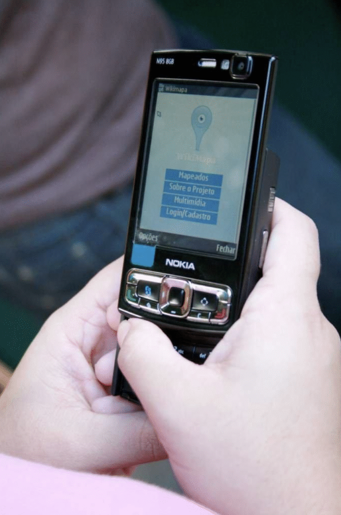
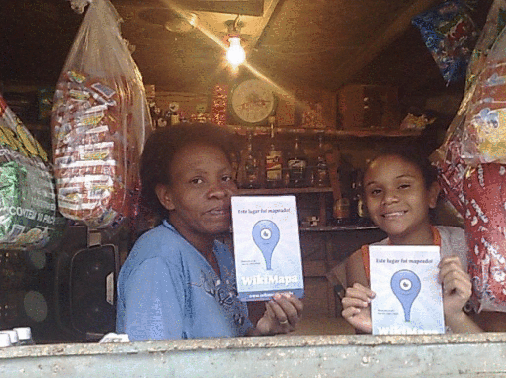
To fix this, a group of 16 youth favela residents’ volunteers (known as wiki-reporters) were equipped with their own mobile phones, walked around the Complexo do Alemão, and photographed locations important to the community life. Some places were hospitals, churches, and schools. Business owners were asked to fill out a form with information about their establishments. The images and information gathered were then geotagged and uploaded to the internet via the mobile app and displayed on a digital map of the favela that could be accessed via a mobile phone or a desktop computer. Once a location was “mapped,” the wiki-reporters gave business owners a physical sticker they could publicly display so other customers would know that location was now part of the map, WikiMapa. They also geotagged people important to the area, such as community leaders, artists, and the oldest resident, Dona Tuca (Mrs. Tuca). Her home received a special pin on the map as she was one of the most well-known people there, having lived there since 1975, and was 81 years old in 2011. She was tagged as she was knowledgeable about the history and did a lot for the community as an artist, singer, and samba dancer.
Many of the residents before this did not have “official” addresses because their sections were not considered part of the city. Now, with this project, it has put the favela on the map, making it easier for public services and the government to know what the community needs and where they are. This helped bring outside investors in, as they now knew what was needed, allowing many residents to start getting proper basic services to the right address (water, electricity, mail). It also made a major social contribution in the community, increasing their self-esteem, dignity, and feeling of citizenship. At the same time, it created a kind of connective intelligence, allowing people to contribute their individual knowledge and connect ideas to create the community’s history. As it got popular in 2011, it was sponsored by the major mobile phone provider in Brazil, Vivo, allowing it to expand to different communities. Unfortunately, due to a lack of funding and sponsorship, WikiMapa ended in 2015.
Connection to Mobile Networked Creativity
This example of Mobile Networked Creativity overlaps with co-creation. While it originated from the project orchestrator (the Rede Jovem Móvel Intivative), it was only possible with the major involvement of the Complexo do Alemão community. The community was not only subjects and participants, but also acted as producers and creators. As the community helped develop the map, it created and strengthened the connections within it. And as the community is always changing and evolving, these types of projects will always need constant participation to be able to highlight the community. These maps also allow them to highlight the socio-economic inequalities in the area to get help from people.
Location
Complexo do Alemão (German Complex), Rio de Janeiro
To Learn More
- Adriana de Souza e Silva, “Making the COVID-19 Pandemic Visible: The Power of Grassroots Mapping Initiatives,” 2022, 16 (2022).
- “Prefeitura Do Rio Mantém Favelas Fora de Mapas Oficiais Dados a Turistas [Rio Municipal Goverment Keeps Favelas out of Official Touristic City Maps].,” Folha de S. Paulo, September 11, 2017.
- Solidaritas, “Wikimapa,” GlobalGiving.
- “Mapping my area: Telefônica Foundation and Rede Jovem launch Wikimapa in Rio de Janeiro,” Fundação Telefónica Vivo.
- Rafael Galdo, “Em Comunidades Do Rio, Salto No Número de Infecções Por Covid-19 Ultrapassa o Dobro Da Média Da Cidade,” O Globo, 2021.
- W. Lance Bennett and Alexandra Segerberg, “The Logic of Connective Action,” Information, Communication & Society 15, no. 5 (June 1, 2012): 739–68.
- Pierre Lévy, “Collective Intelligence: Mankind’s Emerging World in Cyberspace,” trans. R. Bononno (New York: Plenum Trade, 1997).
- Laura E Roberts and Mai N Xiong-Gum, “Wikipedia Editing as Connective Intelligence: Analyzing the Vandal Fighter Role in the 2022 Russian Invasion of Ukraine’’ Wikipedia Article,” 2022, 55–62.
- “WikiMapa maps commerce and points of interest in Cidade de Deus,” Globo.
- “Documentary raises key symbolic and practical questions about marginalized regions that are not on the city’s official map,” Every map Has A Discourse.